
Joyce Country Challenge
Saturday 18th July 2026
Joyce Country Challenge 2026
Date: Saturday 18th July 2026
Location: Finny Community Centre, Co. Mayo
In Aid Of: Galway/Mayo Hospice Foundation
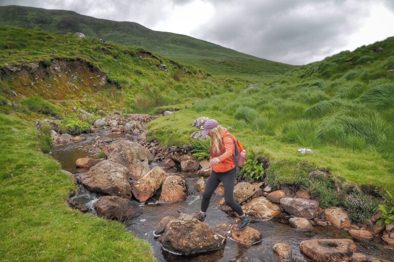
The 17th Annual Joyce Country Challenge offers a unique opportunity to explore one of Ireland’s hidden gems. Set around Lough Nafooey, this spectacular route features breathtaking views of the Maamturks, Mweelrea, Killary Harbour, the Sheeffry Mountains and the Western Lakes.
Walk Options
- A Walk – The Joyce Country Challenge
- 30km | 1,750m ascent | 8–10 hours
- For experienced, fit and self-sufficient walkers with strong navigation skills.
- Note: This is an unled, self-navigation route.
- This is a 30km challenging walk on open Hilltops with 1750m of climbing (duration 6 to 12 hours). This is a walk for the experienced walker with proficient navigational skills to be self sufficient on the open hills. From the start in Finny the 1st leg of the route climbs to Spot height 681, OS Map 38, on the Maumtrasna Plateau. This is the first checkpoint. From there follow the county borderline to Glennlaragh (616m) and to Knocklaur (594m), the second checkpoint. Then descending into the col overlooking the valleys of Sranahaw and Glennacally before the sharp ascent to the Devils Mother (645m), OS Map 37 and long decent to the refreshments station at Ail Dubh (3 rd checkpoint) at the half way point. The 2 nd leg starts with the climb of Currevagh (413m) on to Bunnacuneen (574m) before dropping sharply and climbing again to Ben Beg (559m).Check point 4 (unmanned) is a spot height 467. Follow the ridge above the eastern side of the Lough to Bencorragh(462m) and decend to the finish in Finny. Most of the route is now in the new EastWest map.
- B Walk – Intermediate
- 20km | 750m ascent | approx. 7 hours
- A guided walk suitable for regular hillwalkers.
- The Intermediate Challenge. New route this year! 20km and approx. 750m climb, duration 7 hours. This walk will be lead by experienced Leaders and is suitable for fit walkers who regularly take to the hills as members of an organised Group. The route starts at Finney and ascends Ben Beg, on to Bunacunnen and Currevagh, then down to refreshments station at Ail Dubh. From there it follows the shore line path around Logh Na Fooey and back to Finny.
- Includes refreshment stop at Ail Dubh.
- C Walk – Introduction to Hillwalking
- 3–4 hours
- Beginner-friendly route including local hills around Finny and Kilbride.
- This will take in the hill behind Finny Hall, which is 372m high and onward to Kilbride.
- D Walk – Family Walk (NEW)
- 5km road walk | 3–4 hours
- Easy, scenic route with views of Lough Mask and Lough Nafooey.
- Led by experienced local guides.
Start Times & Registration
- A Walk: Start between 06:30 – 07:30
- B Walk: Sign-on 07:00 – 08:00 | Start 08:00
- C Walk: Sign-on 08:00 – 10:00 | Start 10:00
- D Walk: Sign-on 10:00 – 12:00 | Start 12:00
Entry Fees
- A Walk: €30
- B Walk: €30
- C Walk: €30
- D Walk: €10 per adult (children free)
Registration Details
Pre-registration: Available until Wednesday 16th July via email and online payment.
On the day: Cash only (no card facilities).
Spend a day walking in the stunning Joyce Country region on the Galway/Mayo border. This unforgettable event combines challenge, scenery and community spirit in one of Ireland’s most beautiful and lesser-known landscapes.
Event Details
Location
This event listing is compiled for informational purposes only and is correct at time of publication. All event information may be subject to change by the organisers and you are advised to contact the organisers directly for the most up to date information before you travel. ConnemaraIreland.com cannot be held responsible for any alterations to the listed information.